


Fine 18th Century English Terrestrial Pocket Globe by Cary, London, 1791
Sold
Request Information
Follow Us
Fine 18th Century English Terrestrial Pocket Globe by Cary, London, 1791
Cary’s Pocket globe, agreeable to the latest discoveries, London: J&W Cary, Strand, April 1791
A rare 3 inch diameter example of Cary’s pocket globe in a superb green shagreen-covered case with two silvered hook and eye clasps. The terrestrial globe, itself 3 inches in diameter, covered with copper-engraved hand-coloured gores applied to a plaster and papier maché sphere, the case lined on one half with a map entitled “The World as it was known in Cæsar’s time agreable to D’Anville”, on the other half with “A Table of Latitudes and Longitudes of Places not given on this Globe”. The outer circumference of the spherical case is banded in a silvered metal.
All three voyages of Captain James Cook are marked on the globe, suggesting both the public and Cary’s fascination with these feats of maritime endeavour.
Voyage One. HMS Endeavour, 1768-71. Cook was instructed to undertake a scientific voyage to the Pacific Ocean. He set sail rounding Cape Horn before making landfall in Tahiti, circumnavigating New Zealand, moving up the East Coast of Australia and finally to Indonesia. The newly discovered Endeavour Strait is marked on the globe between Australia and Prince of Wales Island.
Voyage Two. HMS Resolution and HMS Adventure, 1772-75. Cook was commissioned by the Royal Society to sail south in search of the hypothetical Terra Australis. In doing so, Cook became one of the first known explorers to cross the Antarctic Circle. Cook turned to restock in Tahiti just before sighting mainland Antarctica. Terra Australis was not sighted but, having visited New Zealand, the South Sandwich Islands (‘Sandwich Land’ on this globe) were discovered and named.
Voyage Three. HMS Resolution and Discovery, 1776-79. The official public reason for the voyage was to return a pacific islander, from the second voyage, to Tahiti. In reality, the voyage’s principal purpose was to navigate the Northwest passage. Following a stop in Tahiti, Cook made formal contact with Hawaii, before heading north towards the supposed Northwest Passage. While Cook was ultimately unsuccessful in locating the passage, he became the first to chart the majority of America’s Northwestern coast line.
Cook returned to Hawaii where he had previously stopped en route to America. Following an ill-fated encounter with Hawaiians and an argument over ship repairs, Cook and some of his men were killed. This is commemorated on the globe with the inscription ‘Owhyee where Cook was killed 1779’.
The globe also shows the 1780 return journey of the expedition albeit under the command of John Gore and Captain James King. Cook is not the only explorer to be commemorated: amongst other Mackenzie’s 1789 explorations in north-western Canada, showing ‘Mackenzie’s R[iver]’, a decade before Mackenzie’s own maps were published in 1801.
About the makers:
The notable and much celebrated Cary family of cartographers and globe makers were responsible for some of the finest known globes of the period. Having served a seven year engraving apprenticeship under William Palmer, the firm itself was started in London in the late 18th century by John Cary (1755 – 1835) and located at 181 Strand. In producing globes, John often worked in partnership with his younger brother William Cary (c. 1760 – 1825), a scientific instrument maker. This led to the firm being commonly known as J & W Cary. John is widely regarded as the most influential private map maker of his generation. Both John and William also produced maps and other instruments in addition to their globes. Evidence suggests that it was only the globes that were produced jointly.
The first globes by Cary were advertised in the ‘Traveller’s Companion’ in January 1791. The advertisement mentions that differing sizes of terrestrial globes, including a 3 ½ inch, were available and made from ‘entire new plates’. This was seen as particularly noteworthy – the copper plates for the gores were expensive to produce and often used repeatedly through generations.
Condition
Good. Wear consistent with age and use. Globe and hemispheres good with wear commensurate with age. Case good with the usual wear.
Dimensions
Height: 3in. (7.62 cm)
Diameter: 3 in. (7.62 cm)
Literature
Oxford Dictionary of National Biographies
Dahl, Edward H., ‘Sphaerae Mundi’, p.96; Dekker, Elly, ‘Globes at Greenwich’, 1999, pp. 293-295;
van der Krogt, Peter, ‘Old Globes in the Netherlands’, 1984, p,96.
PREVIOUSLY SOLD
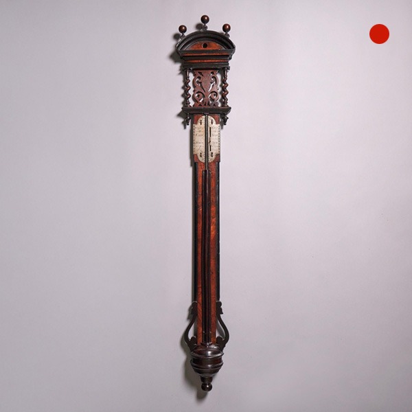
Rare Early 18th Century Queen Anne Walnut Stick Barometer, Circa 1705-1710
Rare Early 18th Century Queen Anne Walnut Stick Barometer, Circa 1705-1710 SoldFollow UsRare Early...
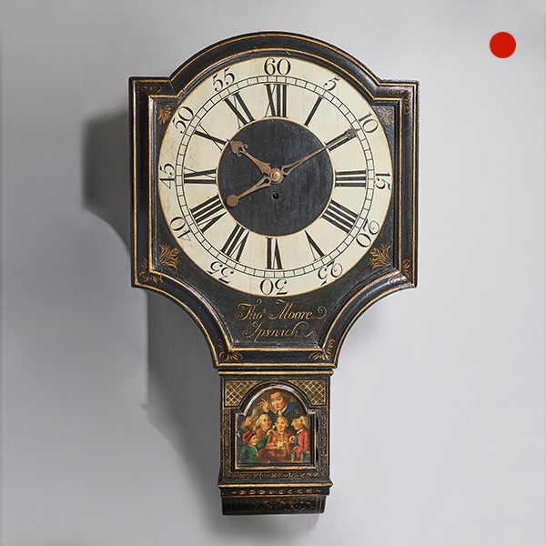
18th Century George II Tavern or Act of Parliament Clock, Circa 1740
18th Century George II Tavern or Act of Parliament Clock, Circa 1740 SoldFollow Us18th Century George II Antique Tavern Clock or Act of Parliament Clock, Circa 1740 Antique Tavern clock by Thomas Moore Ipswich A fine eighteenth-century tavern...
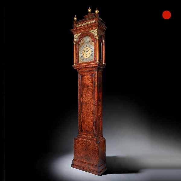
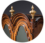
The 10.12ft 18th Century George I Bur/Burl Walnut Month Longcase Clock by James Markwick
The 10.5ft 18th Century George I Bur/Burl Walnut Month Longcase Clock by James Markwick Sold Follow UsThe 10.5ft 18th Century George I Bur/Burl Walnut Month Longcase Clock by James Markwick This is, without doubt, the largest and most...
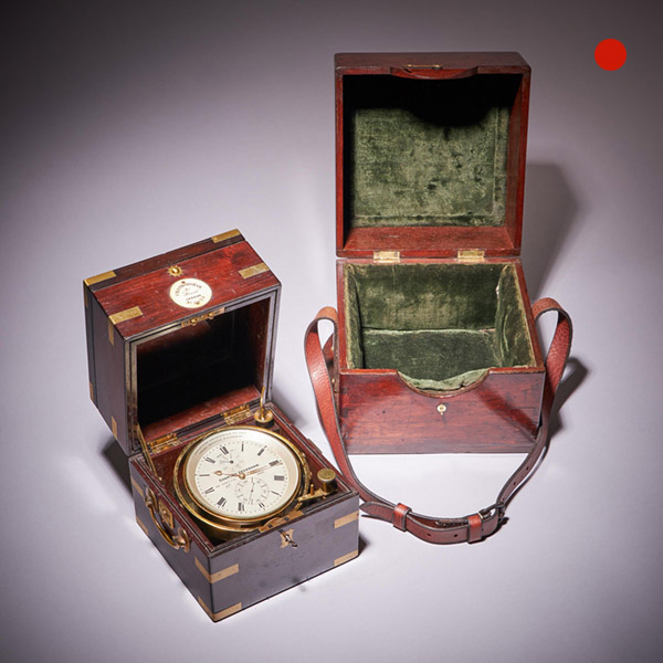
Fine Two-Day Marine Chronometer Signed Charles Frodsham
Fine Two-Day Marine Chronometer Signed Charles Frodsham SoldFollow UsFine Two-Day Marine...
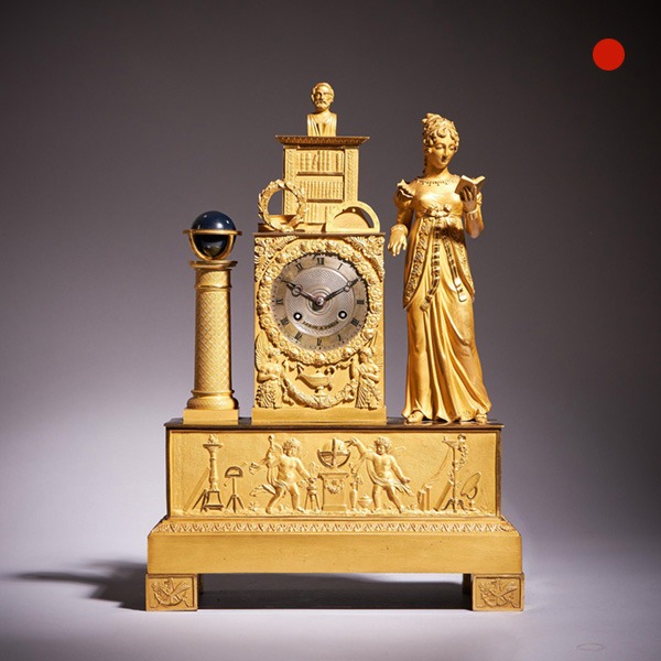
Fine 19th-century French ormolu mantel clock (pendule) by Leroy a Paris, c. 1825
Fine 19th century French ormolu mantel clock (pendule) by Leroy a Paris, c. 1825 SoldFollow UsFine...
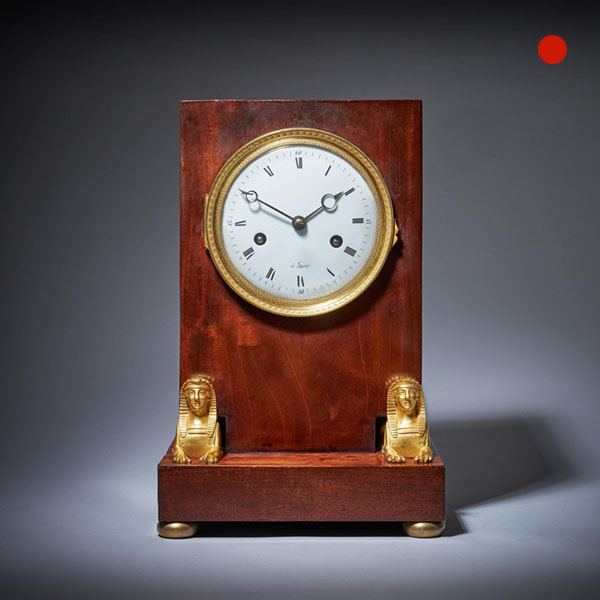
19th-Century French Flame Mahogany Napoleon Empire Period Mantel Clock
19th-Century French Flame Mahogany Napoleon Empire Period Mantel Clock Sold[wpforms_selector form_id="11387" show_title="on" _builder_version="4.22.1" _module_preset="default" custom_margin="-30px||||false|false"...
Rare Early 18th Century Queen Anne Walnut Stick Barometer, Circa 1705-1710
Rare Early 18th Century Queen Anne Walnut Stick Barometer, Circa 1705-1710 SoldFollow UsRare Early...
18th Century George II Tavern or Act of Parliament Clock, Circa 1740
18th Century George II Tavern or Act of Parliament Clock, Circa 1740 SoldFollow Us18th Century George II Antique Tavern Clock or Act of Parliament Clock, Circa 1740 Antique Tavern clock by Thomas Moore Ipswich A fine eighteenth-century tavern...
The 10.12ft 18th Century George I Bur/Burl Walnut Month Longcase Clock by James Markwick
The 10.5ft 18th Century George I Bur/Burl Walnut Month Longcase Clock by James Markwick Sold Follow UsThe 10.5ft 18th Century George I Bur/Burl Walnut Month Longcase Clock by James Markwick This is, without doubt, the largest and most...
Fine Two-Day Marine Chronometer Signed Charles Frodsham
Fine Two-Day Marine Chronometer Signed Charles Frodsham SoldFollow UsFine Two-Day Marine...
Fine 19th-century French ormolu mantel clock (pendule) by Leroy a Paris, c. 1825
Fine 19th century French ormolu mantel clock (pendule) by Leroy a Paris, c. 1825 SoldFollow UsFine...
19th-Century French Flame Mahogany Napoleon Empire Period Mantel Clock
19th-Century French Flame Mahogany Napoleon Empire Period Mantel Clock Sold[wpforms_selector form_id="11387" show_title="on" _builder_version="4.22.1" _module_preset="default" custom_margin="-30px||||false|false"...
YOU MAY ALSO LIKE
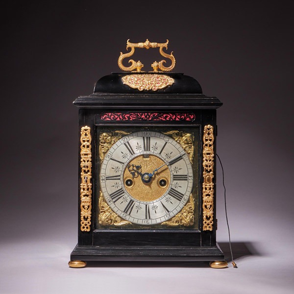
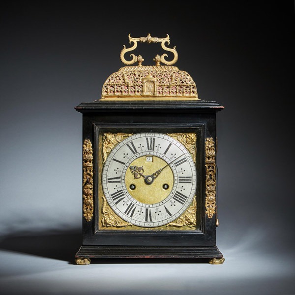
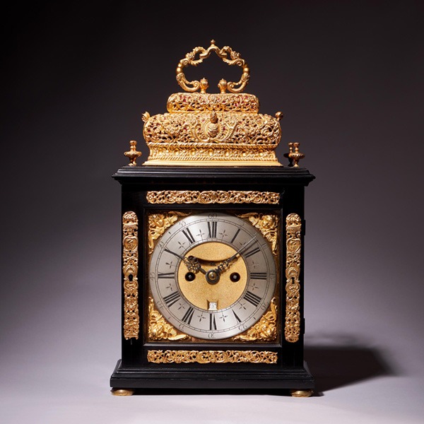
A 17th Century William and Mary eight-day table clock by Isaac Lowndes, 1695
A 17th-Century William and Mary eight-day table clock by Isaac Lowndes, 1695 £26,900Follow UsA...
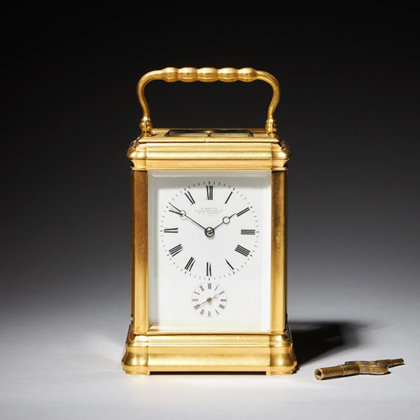
A superb 19th century eight day grande sonnerie carriage clock, circa 1870.
A superb 19th century eight day grande sonnerie carriage clock, circa 1870. £3,950Follow UsA...
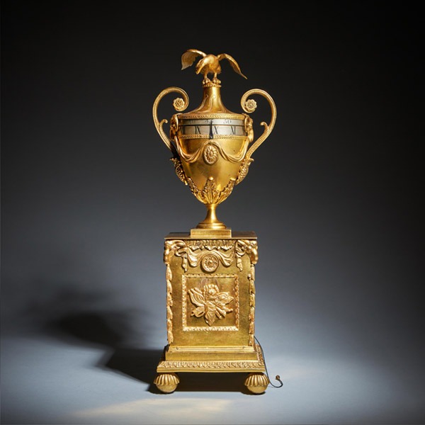
A Unique 18th Century Georgian Urn Clock by Paul Rimbault Soho London 1770
A Unique 18th Century Georgian Urn Clock by Paul Rimbault, Soho London, 1770 £34,900Follow UsA...
17th Century English eight-day spring-driven table clock by John Wrench
17th Century English eight-day spring-driven table clock by John Wrench £26,900Follow Us17th...
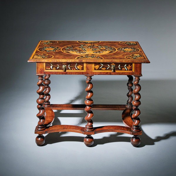
Highly Important 17th Century Charles II Floral Marquetry table by Gerrit Jensen
Highly Important 17th Century Charles II Floral Marquetry table by Gerrit Jensen £68,000Follow...
A 17th Century William and Mary eight-day double basket table clock by Asselin
A 17th Century William and Mary eight-day double basket table clock by Asselin £26,900Follow UsA...
A 17th Century William and Mary eight-day table clock by Isaac Lowndes, 1695
A 17th-Century William and Mary eight-day table clock by Isaac Lowndes, 1695 £26,900Follow UsA...
A superb 19th century eight day grande sonnerie carriage clock, circa 1870.
A superb 19th century eight day grande sonnerie carriage clock, circa 1870. £3,950Follow UsA...
A Unique 18th Century Georgian Urn Clock by Paul Rimbault Soho London 1770
A Unique 18th Century Georgian Urn Clock by Paul Rimbault, Soho London, 1770 £34,900Follow UsA...
17th Century English eight-day spring-driven table clock by John Wrench
17th Century English eight-day spring-driven table clock by John Wrench £26,900Follow Us17th...
Highly Important 17th Century Charles II Floral Marquetry table by Gerrit Jensen
Highly Important 17th Century Charles II Floral Marquetry table by Gerrit Jensen £68,000Follow...
A 17th Century William and Mary eight-day double basket table clock by Asselin
A 17th Century William and Mary eight-day double basket table clock by Asselin £26,900Follow UsA...